Please note: This article became outdated with Nokia's announcement of free navigation to all handsets on January 21st 2010. Please see the updated article, which has some new content and some copied from here. Link.
During my time with Symbian phones, I have always flipped back and forth between favouring Google Maps, then Ovi Maps, then back again, but which is best? I recently decided it was time to make an objective study of the two, and settle the question once and for all. I chose five key areas on which to assess each application. Mapping views looks at which application has the most detailed maps. Pre-loading looks at how easy it is to get mapping data to your phone before you'll need it in the field. Discovery & search looks at how well the applications help you find and explore locations. Sharing & Synchronising looks at how easily you can get landmarks exchanged between your phone and the cloud, and then share them with others. Navigation, as you might expect, assesses how accurately you can pinpoint your location and make your way to your destination.
Mapping Views
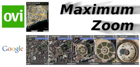
Both Ovi and Google will display a standard map view and a satellite photo view. Unfortunately, the resolution of the Ovi satellite photos is too low to be useful. However, Google satellite photos are of such a high resolution that you can recognise individual buildings and road markings. Meanwhile, Ovi has an added 3D terrain view. Although, considering that the primary usage for these applications is probably street navigation, I think the terrain height information is of limited use, especially since it is unquantified.
WINNER
Google Maps wins with the highest resolution satellite photos.
![]()
Pre-loading
Both Google and Ovi will fetch map images from the internet on the fly. In fact, this is the only way that you can use Google Maps. However, Ovi Maps does allow you to pre-load maps with the (Windows and Mac) Nokia Maps Loader, which can be a great time and money saver. Although, Google Maps does cache map images, to a degree, within a session. Therefore, it is possible to pre-load Google Maps via your home WiFi before you go out, as long as you know where you are going to go and don't close the app. This method also means you'd need to pre-load for every zoom level you think you might use, and for map and satellite views too! A tiresome exercise, although it would mitigate any potential data charges.
WINNER
Ovi Maps' pre-loading can save you time and money.
![]()
Discovery & Search
As part of the preloaded packs in Ovi Maps, it is possible to overlay icons for all sorts of services that you might be looking for while you're out and about. However, in my anecdotal research, this data is largely out of date and incomplete. This may improve with the launch of "Ovi Prime Places", a service that invites businesses to add themsleves as points of interest in the Ovi Maps database. Mind you, it has yet to be seen how quickly this will be adopted by businesses, and how long it would take to match the comprehensive database of Google Search.
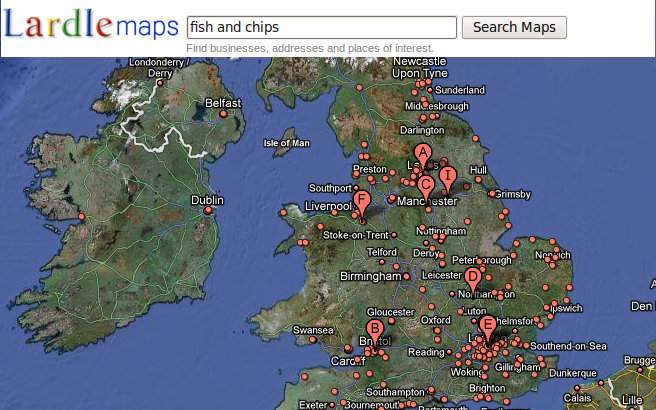
In contrast, as you might expect from Google, you can easily and accurately search for specific places, because Google has constantly up to date information based on its web search business. Simply searching for something like "Restaurants" will give you a map full of search results. Not only are there location details there, but there are also user contributed reviews. All that Ovi currently has to offer is their "Good Things" service, which isn't even accessible on mobile devices.
WINNER
Google's existing strength in the search business wins the day.
![]()
Sharing & Synchronising
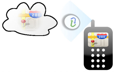
Ovi Maps is out of the gates first, offering you quick and easy two way synchronisation between your phone and the Ovi cloud. Your landmarks are viewable on your phone and the web. Both ends are updated as soon as you quit or restart the mobile application.
Until recently, all you could do with Google was to create "layers" (landmarks, lines and/or shapes) on the Google Maps website which were then available to your phone in a read-only form. However, with the announced release of version 3.3 of Google Maps Mobile, you can now create "starred places" on either the mobile application or the website, and they are synchronised between your phone and the cloud when you start the application. This has, however, broken the cooperation between the Google Maps and Ovi Maps applications (apart from an initial upload when starting v3.3 for the first time). Before, landmarks created in the Google Maps application were saved in your S60 landmarks application, which could then be synchronised with Ovi, effectively allowing the two applications to complement each other. This is sadly no longer the case.
On the sharing side, Ovi has the perfect platform for sharing and collaborating with its "Good Things" service, but at the time of writing, anything shared in Good Things only exists on the web. On first impressions, Google Maps seems to have a slight edge, by allowing you to publish your layers. However, user-created public layers are not available on the mobile application. The only public layers available to Google Maps Mobile are so-called "Favourite Places" layers. You soon find that "Favourite Places" only covers selected capital cities around the world. What's more, favourite places in each city are grouped under the individuals who made them, and those individuals are limited to celebrities. I think this is a useless way of doing things for a number of reasons. Firstly, if you're looking for new places to go, you need to search by the type of place you want. Secondly, if you are a celebrity of some measure, it doesn't automatically make your landmarks more interesting, and you could have a conflict of interest, due to the attention that your reputation attracts.
This leaves Google Maps in the same state as Ovi Maps. Both have two way synchronisation of landmarks. Both suffer from having user contributed content locked to the web, which is of no use when you're on the street deciding where to go.
DRAW
With the release of GMM 3.3, Google and Ovi are evenly matched
![]()
Navigation
Both Google Maps and Ovi Maps can track your location, even if your phone doesn't have a GPS receiver. This service is called "My Location" (on the former, explained on Youtube). By triangulating your position relative to the nearest cell towers, it can give your position to within a 1000 meter radius.
Android phones with Google Maps enjoy the benefit of a digital compass, but support for compass-equipped S60 phones is sadly missing. Therefore, you have to turn to Ovi Maps if automatic map rotation is important to you. This is no doubt useful, but I don't think judging your orientation on an urban map is that difficult.
Both applications offer walking directions, and in my experience, I don't think one beats the other. The two differ however on road directions; Google Maps give all directions for free, while Ovi Maps requires a subscription, as recently bemoaned by Steve Litchfield. In addition to road directions, Google Maps also offers traffic congestion updates via its layers system. The effectivness of this is limited to how many other Google Maps users are in a given area, but it is better than nothing and the price is right.
For driving use, Ovi Maps wins hands-down, thanks to the hands-free voice instructions (once paid up), but a future version of Google Maps is likely to also have this feature, as has been demonstrated in the USA under Android 2.0.
When it comes to accuracy, either application is only going to be as accurate as the GPS receiver in the handset. However, I observed in my tests that Google Maps updates your location with a greater frequency than Ovi Maps, which does indeed increase the accuracy of your position on the map. Slower location updates lead to jumps and poor extrapolated guesses of where you might be. For example, while you are indeed a good driver, Ovi Maps will display you cutting a street corner in such a way that would probably get you arrested if you'd really driven like that!
WINNER
Google's fast location update & free road directions win, on balance.
![]()
Conclusion
![]()
WINNER - Google Maps
Thanks to constantly updated search and superior location accuracy, I believe that the S60 version of Google Maps has more day-to-day practical benefits than Ovi Maps. This is not to say that we should write off the latter. It has some advantages over Google Maps, and has the potential to be better, as long as Nokia realises and exploits this potential.
David R. Gilson, 15th December 2009.
You can find me at my blog and on twitter, @davidgilson.
