The addition of photo-realistic 3D models makes it possible to move around a city in three dimensions, offering a more realistic digital mapping recreation of the real world. The controls allow you to move from a zoomed out, birds eye view, to a zoomed in, building level view, which can be viewed from any orientation or perspective.
Michael Halbherr, senior vice president, Nokia, said:
"Ovi Maps' photo-realistic 3D models of metropolitan areas are a significant step towards our vision of bridging the real and virtual world, with location-based services being the glue".
While the additional views are for the web version of Ovi Maps, it is clear that this kind of user experience could be added to a future version of the mobile version of Ovi Maps. The unveiling of the product is a powerful reminder of the importance that Nokia attaches to location and mapping technologies.
Photo-realistic 3D building view
For the provision of photo-realistic 3D buildings, Nokia has partnered with C3 Technologies, a company that specialises in 3D mapping solutions. The technology works by combining many captured images together, as Nokia Conversations explains:
C3 uses modern camera equipment to capture as many as one image per second of the same object from up to 100 different angles. The images are then used to automatically reproduce the shape of the objects with very high accuracy. After that, an image processing software automatically drapes each shape with the texture chosen from the pictures of each object. The same process is being applied for all objects – buildings, houses, trees, and hills – the result is a seamless canvas of 3D-data where the resolution (8 to 12 centimeters per pixel) and quality is consistent over the entire model. This is the secret to C3 maps’ realistic look compared to competitors’ hand-made and cartoonish appearance.
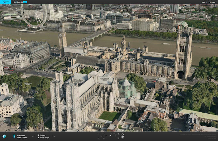
Westminster Abbey and the Houses of Parliament, London
The new 3D view can be compared with a number of competing solutions, such as Google Earth and Bing Maps. However, the Ovi Maps solution provides more detailed 3D models and a greater degree of photo realism (typically competing solutions use simple box models, overlaid with satellite photos). The differences in quality are especially notable when looking at lower profile objects.
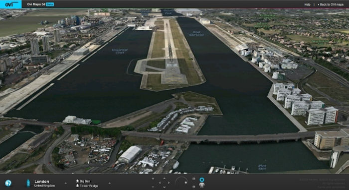
London City Airport
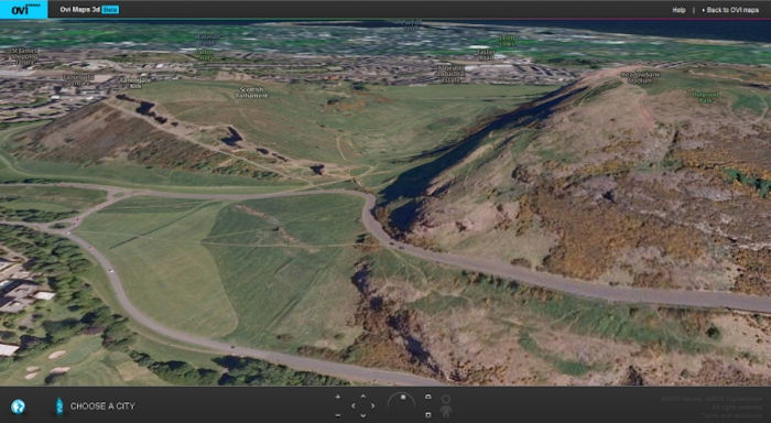
The photo-realistic 3D models are currently available in twenty metropolitan areas, with more to come. However, that does not stop 3D being used in the rest of the world. Outside of the covered areas, satellite maps are stretched over a digital elevation model, giving a sculpted landscape view (similar to earlier implementations of the web version of Ovi Maps). For example, the screenshot below shows a view of the North of Edinburgh with the dormant volcano of Arthur's Seat and Salisbury Craggs, showing the technique:
Street level view
A street level view, based on data captured by Navteq's fleet of data collection vehicles, has been made available for five cities. The data set is made up of interconnected 360 degree panoramas, captured as a vehicle drives along a road. Once in the street level view you can move from panorama to panorama using the overlaid arrows.
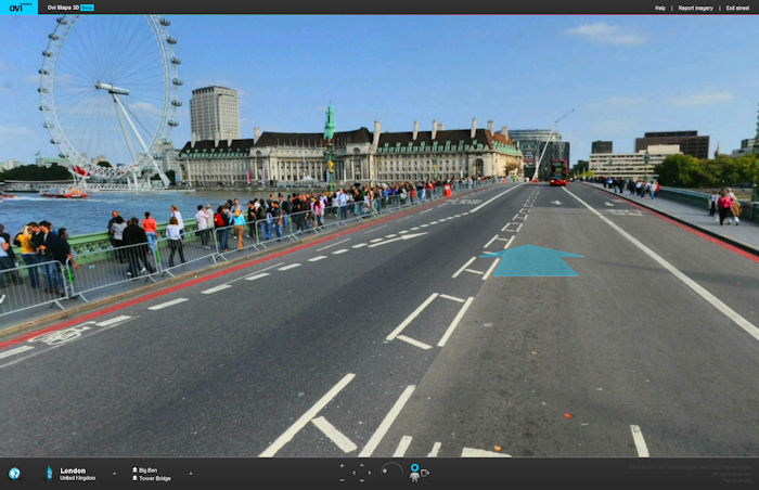
Westminster Bridge, London
The street level view can be accessed by clicking on one of the blue circles that appear, in 3D view, when you hover your mouse over a road that has imagery available. An example from Copenhagen is shown in the screenshot below:
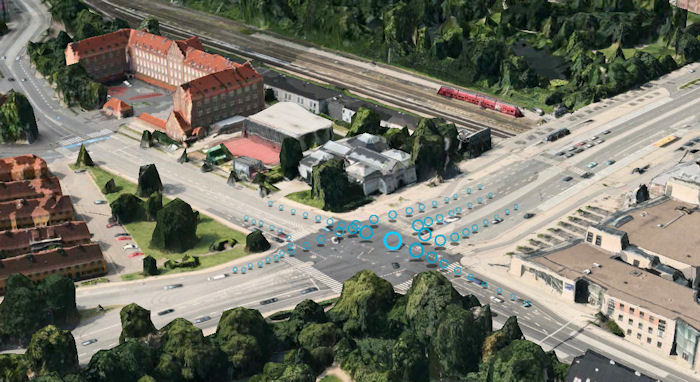
Copenhagen, Demark
The product and its implementation is similar to Google's Street View technology, but both represent only a first generation implementation of a street level view. In the future, we can expect to see photo-realistic 3D models created as the street view level (Navteq True is one possible data source for this).
Ovi Maps 3D
Currently Ovi Maps 3D is available for Internet Explorer 7+, Firefox 3.5+, Google Chrome, IE 7+ and Safari 5+. More at Nokia Conversations and in this Nokia press release, or you can have a play yourself at maps.ovi.com/3d.
3D maps are available for San Francisco, New York, Miami, Boston, Chicago, Los Angeles, Las Vegas, Toronto, London, Helsinki, Stockholm, Oslo, Copenhagen, Milan, Venice, Florence, Barcelona, Madrid, Prague, Vienna, and more to come.
The street level view can be seen in London, San Francisco, Helsinki, Oslo and Copenhagen.