Mapping seems to be the touchstone of features in modern smartphones, and no more so than on the Nokia N95, one of the most up to date phones with GPS - while it comes with its own mapping client, I've been spending a lot of time in Google's Java-based Google Maps. How do the two stack up against each other?
The Applications
Google Maps for Mobile is a Java MIDP implementation for the Google Maps/Google Local service and is a free download from http://maps.google.com/mobile/. Smart2Go (also known as Nokia Maps) is bundled in the firmware of the Nokia N95 and is also available to download from http://www.smart2go.com/. It’s a free download, just as Google Maps for Mobile is, but it’s worth pointing out that Smart2Go is written in native C++, as opposed to being a Java Midlet, so there is more complexity to the application.
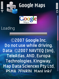
Splash screens - Google Maps on the left, Smart2Go on the right
But part of this complexity in Smart2Go includes all the route planning and discovery functions, being part of the device – doing location searches takes more time on Smart2Go than on Google Maps – because in the latter's case the Java client passes all the heavy lifting and calculation to a room full of computers back at ‘The Googleplex’
Result: No overall winner.
Map Data
Both applications load the map data ‘over the air’ as required, and thankfully you can use Wi-Fi instead of your data plan, because you can shift a lot of data as you move around. In terms of data usage, Smart2Go is a touch more efficient in loading data as you need it, although this is balanced out by the ability to switch over to the satellite view in Google Maps and get an actual visual from the sky (although it can be up to three years old).
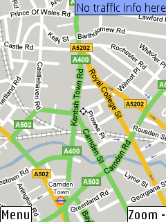
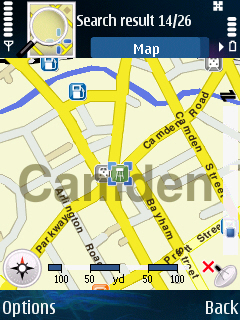
Looking at Camden (Google on Left, Smart2Go on right)
But Smart2Go has a trick up its sleeve. Side-loading the map data. By downloading the MapLoader PC client, you can download and store the data for entire swathes of the world on the storage card of your smartphone. You’ll need to leave plenty of room (England is about 120MB for example, while the state of California is 75MB) and have plenty of time because the data can take a while (tens of minutes, even with MapLoader 1.1), but knowing that you won’t need to go online while out exploring is worth all the effort.
Result: Smart2Go
Locations
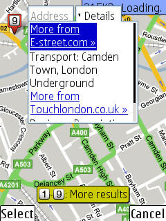
Both applications allow you to search for locations and points of interest and to subsequently save them, so both have the functionality – Smart2Go does start off with a pre-populated database of a number of points, including train stations, underground stations, garages and some tourist attractions, which makes it a much more immediate approach. Once you start to 'search nearby' the current map location, you get a category breakdown and then a list of requested items. It's a much broader base of searching, so you can't just search "coffee in Camden" but under the bars and Restaurants category. It looks nicer but feels a lot less detailed because of this.
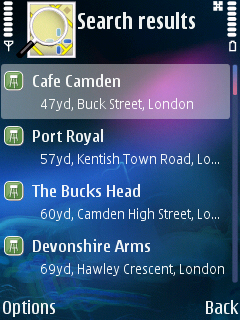
Google Maps requires that you search for businesses, but with the might of Google’s search technology behind them you have a much larger database, resources and information available to you when you do want to find something, as opposed to some place.
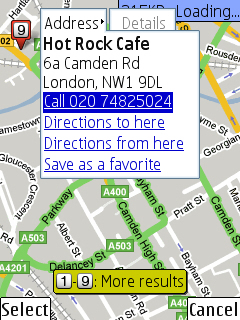
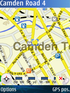
Google Maps on the hunt for Coffee
Navigation
But on the other hand, walking around using your smartphone to find a second hand bookstore that stocks “Fly Fishing” might not be your thing, and you need the direction and route finding capability. Google Maps loses here partly because it kept mis-locating some of my saved favourite locations, and because there’s no tweaking of the route – you get what the server gives you and you’d best be happy. Smart2Go is similarly lightweight in the planning tweaks, but the ability to ‘tilt’ the map to a 3D view makes it easier to relate to the route as you are travelling along it. And you can get a simple list of instructions as well with Smart2Go, an offer not available on Google Maps.
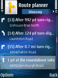
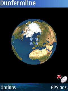
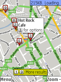
Navigation on Smart2Go
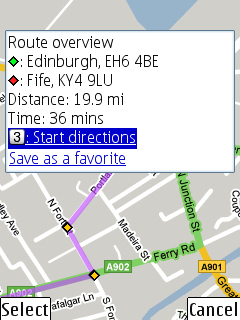
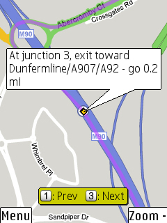
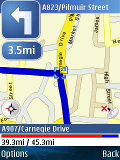
Navigation on Google Maps
The big problem is that neither of the applications managed to get the most natural route from my house to my parents house. Google Maps sent me on a 40 mile wild goose chase half way down the River Forth to the Kincardine Bridge, some 20 miles from the Forth Bridge, which is much more convenient, and closer. Smart2Go, while at least picking up which water crossing was closer, was more than happy to drive around the back streets of Edinburgh to save a few tens of meters of distance.
The lack of options to tweak the routes in either application is something that needs to be addressed - be it the type of roads to prefer, or even an option to specify whether shortest distance or shortest time should be biased. They also need to be a lot more robust in checking a route to make sure it is genuinely useful, rather than something that looks good.
While the route planning capability is roughly similar, Smart2Go wins out because of the different presentation options, including the tilted option, which is very useful when driving.
Result: Smart2Go (Just)
Integration
There’s very little contest here – even though the N95’s built in GPS isn't exactly cutting edge (though with the new v12 firmware with Assisted GPS support it's much better than it was), the integration of this, or a relevant Bluetooth GPS unit, makes the Smart2Go package the one to use if you are a GPS fan. At this moment, there's no GPS support in Google Maps for Mobile, not for any technical reason, but because Google haven't got around to adding it in yet. Rumour has it that this is coming...
Result: Smart2Go
Summary
The result in favour of Smart2Go (at 4-2) is probably more an indication that the more powerful you make a local piece of software, the more it will outperform a thin client-server architecture – although balance that with the grunt of the back-end servers and computers for route calculation and searching. Of course, with both apps as freeware there’s no reason to not have both of them in your smartphone – given the choice, I’d plump for Google Maps, but that’s more because I don’t drive, so the local information is much more valuable to me than how to get a car to Bangor. Now, where’s that unlimited data plan….
Ewan Spence, 10 July 2007