With the likes of Sports Tracker and other existing GPS/camera integration software, this is an area that definitely needed simplifying and integrating. Over to Rafe for a walkthrough of Location Tagger:
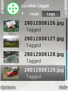
Location Tagger is a standalone application, but it closely integrates with the Camera application. On start up it will automatically start the GPS and will automatically tag photos with location information as they are captured. The application has a log view which allows you to see recently captured images and whether they have been tagged or not.

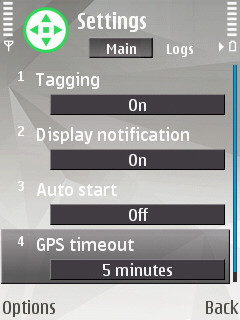
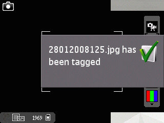
In the Camera application the small green icon indicates that Location Tagger is running (the icon will be orange if there is no GPS fix, or red if tagging is turned off or no GPS is available). After capturing an image a notification message appears letting you know the image has been tagged.
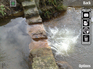
You can use an application such as Share Online (version 3 recommended) to send the location tagged photos to Flickr.
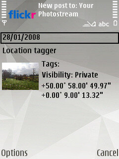
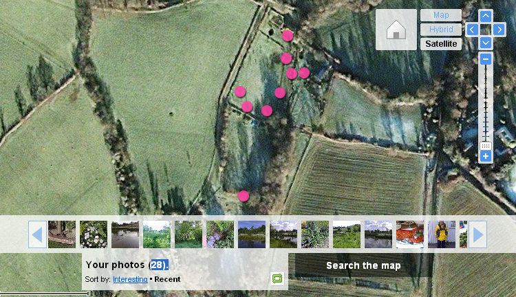
To get the most out of Location Tagger you will need to use a tool to visualise the location information. The easiest way to do this is to upload your photos to a service such as Flickr or Picasa that lets you view your photos on a map. Here is an example, from Flickr, of the way geotagged photos can be visualised on a map / satellite photo:
More information is available on the Location Tagger website. You may also want to read this blog post by Anthony Pranata (of Screenshot fame) who is one of the Nokia people behind the project. It explains how the plan is to integrate location tagging seamlessly into the S60 experience (it will become part of the Gallery and Camera applications). The Location Tagger Beta Labs release is a chance to provide people with a preview of what is to come.
How does it work?
Geotagging is the writing (or tagging) of location (geo) information into an image file. The information is stored in the EXIF header of the JPEG file. EXIF headers are a standard way to store meta data (general information) about the image file.
EXIF data is standardised and thus services such as Flickr can read the location information and use it to place a photo at the appropriate place on a map.
For example a photo captured on an Nseries phone will have EXIF data specifying the camera model (e.g. N82 in example below) along with a variety of other information. Location Tagger write location information to the EXIF headers. You can access EXIF data in most image editing programs. On Windows you can access this information by viewing the file properties as shown below.
