Of course, the resources to do all this for much more of the world's urban areas would be enormous, but we'll settle for this as both a good start and a good demo of Nokia's 3D mapping technology.
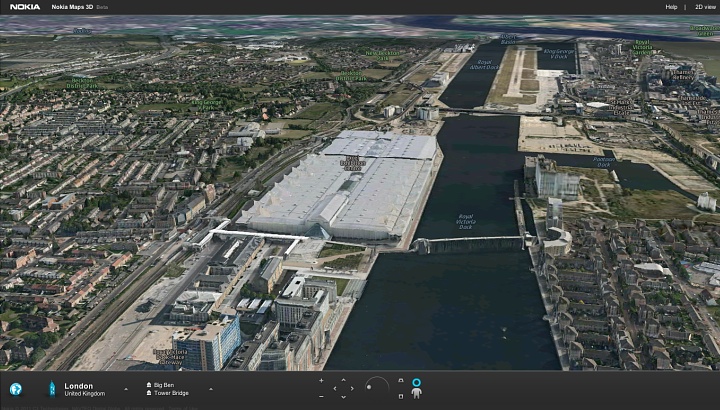
And, just to be topical, here's London's ExCeL centre, as viewed in Maps 3D in Chrome on my desktop:

This is where the AAS team will be for the next 48 hours!
Nokia Conversations just announced that Maps 3D is being implemented in WebGL, which means that soon you'll be able to enjoy all this without having to install a plug-in into your web browser:
First of all, a nice surprise for the location fans among you: the wonderful Nokia Maps 3D is going to be 100% 3D and 0% plugin. If you want to give it a try, it’s been available for a while. All you need to do is point your browser (only Chrome at the moment, other browsers are being tested) tohttp://maps.nokia.com/webgl
